As the Land Trust looks for ways to improve upon the methods used to monitor and track significant ecological changes at our properties over time, we have recently started to implement the use of Unmanned Aerial Vehicles (UAVs), commonly referred to as drones. UAV technology has grown substantially in recent years and many land management organizations are realizing the benefits of being able to capture high quality aerial imagery to supplement photos taken at ground level—when it's done in a thoughtful, well-planned manner.
Traditionally, when the Land Trust conserves a property, a set of on-the-ground “photopoints” are established at various places of interest within the property to document existing conditions. Those photopoints are GPS referenced and then revisited annually to be able to keep tabs on any relevant changes, such as stream or forest restoration projects, fluctuating weed populations, native vegetation health, and trail and infrastructure conditions. However, as the Land Trust continues to grow and protect more—and sometimes larger—properties, it is becoming clear that traditional ground level photopoints are not always the most effective or efficient option for monitoring purposes, especially when factoring in the terrain and time it would take to hike throughout a given property. In addition, it is often hard from ground level to capture the scale necessary to really understand the area and what has changed. This is where the use of UAV aerial imagery has proven to be very valuable. With the use of a UAV and a compatible automated flight software, the stewardship team is now capable of establishing repeatable aerial photopoint flight plans that follow a custom polygon around a given focal point. See the picture below to get a better sense of what that means.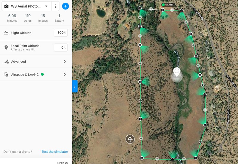
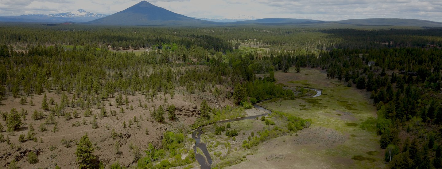
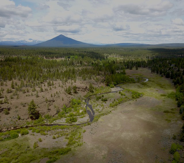
As seen in the picture, the UAV automatically flies the green polygon at a set altitude and takes a photo at each camera icon pointing in the direction of the white focal point in the middle—all in about six minutes. Not only does this yield valuable aerial imagery in a relatively short amount of time, it is also repeatable, thus ensuring that photos taken in subsequent flights will be taken from the same location and perspective. In this particular example from Willow Springs Preserve, the Land Trust is planning to implement a stream restoration project in the next couple of years, which is why the focal point was set near Whychus Creek. Having a set of before and after photos looking at the creek from different angles will be very advantageous to visualize how much and how fast the area evolves post-restoration. Below are a few of the images captured during the initial flight at Willow Springs Preserve.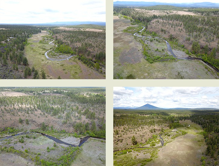
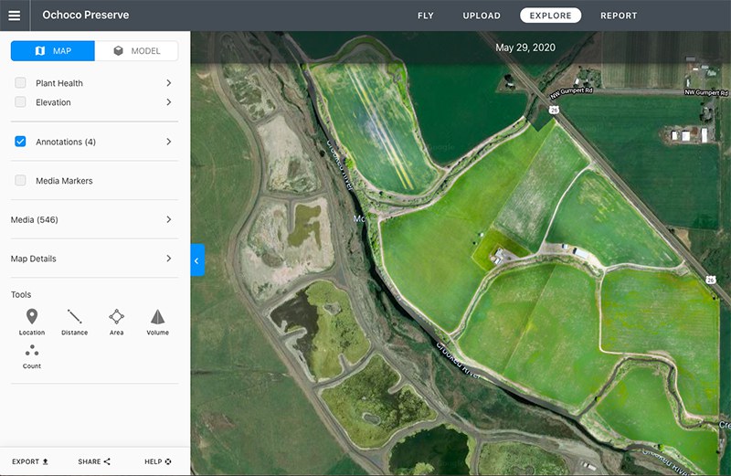
Along with creating aerial photopoint sets, another feature of using a UAV with automated flight software is the ability to create high-resolution orthomosaic maps of certain areas or entire properties. An orthomosaic map is the combination of many single images that are stitched together and geometrically adjusted (orthorectified) so that the final map is an accurate photo representation of an area. This feature is particularly useful on properties whose boundaries are adjoining closed polygons. This is due to the fact that the boundary data can be uploaded into the software and the entire property can be captured. The example below details the flight plan that was used to create a detailed orthomosaic map at Ochoco Preserve.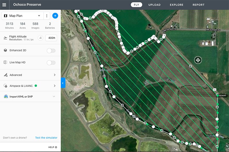
It will be exciting to continue to compile robust sets of aerial imagery for our Preserves going forward, showcasing the various ecological changes that are expected to occur in coming years.