***3/9/26: Whychus Canyon Preserve is closed due to impacts from the Flat Fire through June 2026. Please respect all closures and stay out of the area to help with recovery. Learn more.***
Whychus Canyon Preserve is a 930 acre Preserve on Whychus Creek near Sisters, Oregon. It was first established in 2010 and an additional 480 acres was added in 2014. The Preserve contains four miles of Whychus Creek, high quality grasslands, old growth juniper, cottonwood and aspen stands. With such a diverse range of habitats, Whychus Canyon Preserve is home to a variety of fish and wildlife.
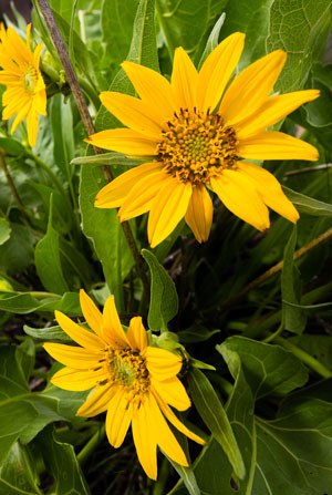
Arrowleaf balsamroot at Whychus Canyon Preserve. Photo: Tyler Roemer.
Watch for wildflowers: Whychus Canyon Preserve is home to a host of native wildflowers. The Preserve's sagebrush plateaus are the first to warm up each spring delighting hikers with some of the earliest blooms. Learn more about the Wildflowers of Whychus Canyon Preserve.
Learn some history: The Santiam Wagon Road crosses the Preserve, providing a glimpse into one of the main paths of commerce and settlement for Central Oregon. Walk the nearby Wagon Road to learn more.
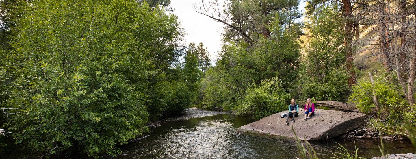
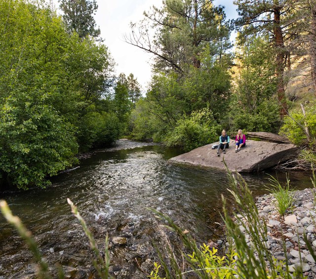
Explore Whychus Creek: Four miles of Whychus Creek flow through the rock canyons and meadows of the Preserve. Hardy hikers can follow trails down to the creek and enjoy the lush ribbon of green vegetation.
Enjoy scenic vistas: Hikers can enjoy spectacular scenic vistas from rock outcroppings above the canyon rim. Keep an eye out for rattlesnakes.
Whychus Canyon Preserve protects four miles of Whychus Creek, juniper and pine forest, rimrock canyon, and native grassland habitat that provides habitat for a wide range of wildlife from redband trout and salmon, to mule deer and Rocky Mountain elk, golden eagles and spotted bats. Whychus Canyon Preserve contains one of a handful of important, biologically rich meadows on Whychus Creek where the creek slows down, spills its banks, and provides diverse habitats for fish and wildlife. The Preserve’s creek restoration project is helping restore the creek to a healthy, biologically diverse condition.
Whychus Canyon Preserve also provides low-impact accessible recreation opportunities that allow the local community to enjoy and connect with the natural world, gain physical and mental health benefits, while also ensuring that our meadows and streams remain protected and available for generations to come. The Preserve provides a network of trails that provide the only public access to Whychus Creek between Sisters and the Crooked River National Grasslands. Other community values include helping maintain the scenic character of the region and protecting cultural and historic resources. Finally, Whychus Canyon Preserve helps mitigate the impacts of climate change by helping store CO2 and by restoring and growing native vegetation that removes CO2 from the atmosphere. Land conservation is climate action, and our forest restoration efforts increase fire resiliency for surrounding communities.
Whychus Creek after being restored. Photo: Land Trust.
The Land Trust manages Whychus Canyon Preserve to protect and, where necessary, restore fish and wildlife habitat. Since acquiring the Preserve in 2010, the Land Trust has completed a variety of restoration projects including:
Forest restoration. The Land Trust’s forest restoration efforts at Whychus Canyon Preserve have been focused on restoring the forested areas of the Preserve to a healthy, open ponderosa pine/juniper savanna that provides high quality wildlife habitat, helps protect adjacent neighborhoods from catastrophic fire, and helps our forests adapt to climate change. Learn more.
Stream restoration. We are currently working with our restoration partners to restore six miles of Whychus Creek (Whychus Canyon Preserve downstream through Rimrock Ranch). Learn more about the creek restoration.
Managing weeds. Noxious weeds are a reality at all Land Trust protected lands. If they are not actively managed they compromise healthy native plant communities. Weed management is currently focused in the stream restoration project area.
Whychus Canyon Preserve is accessed via the Goodrich Road trailhead. The Preserve is open to the public during daylight hours year-round.
Whychus Canyon Preserve offers the following amenities:
Trailhead with informational kiosk and wooden benches. Trailside interpretive signs.
Loose gravel parking area for 10 cars.
7+ miles of predominantly narrow (<36”), natural surface trails. Some routes include significant (300’) elevation gain and loss, with steep terrain and/or rocky stair sections. Trails can get muddy in the winter and spring, please avoid using them during these times. Learn more about trails and routes at the Preserve.
Scenic overlooks with rock and wooden benches.
Portable restroom.
No drinking water or trash removal services and shade is limited. Cell phone reception is limited. Snow may block access to the Preserve in the winter. Watch our video below to learn more about visiting the Preserve.
Preserve guidelines
Use of Whychus Canyon Preserve is conditional upon following these and any other posted rules:
Dogs must be kept on leash at ALL TIMES. Please clean up after your pet.
Pedestrian travel only: no bike, horse, or motorized vehicle use.
Stay on roads and trails and respect restrictions as posted.
Removal or disturbance of plants, wildlife, and historical artifacts is prohibited.
Follow state laws when fishing on the Preserve.
No hunting, camping, campfires, smoking, or unmanned aircraft use.
Commercial use and private events are prohibited.
Please note: Whychus Canyon Preserve is private property owned by Deschutes Land Trust. Your use of the property is conditional upon these and any other posted rules. Preserve users failing to observe posted rules are trespassing and subject to applicable laws and penalties. Visitors to the Preserve may encounter risks associated with terrain, wildlife, and weather. Please exercise appropriate caution: the Deschutes Land Trust is not liable for injuries to Preserve visitors.
Whychus Canyon Preserve is located northeast of Sisters, Oregon. Access to the Preserve is via the Goodrich Road Trailhead. Trail maps and detailed driving directions (including mapping app links/details, GPS coordinates, and downloadable PDFs) can be found below.
Trail maps: View the trail map and route suggestions for Whychus Canyon Preserve (in English or en Español) or download a georeferenced map (in English or en Español) for use in mapping apps.
Driving directions to Whychus Canyon Preserve: Please note: all public access to Whychus Canyon Preserve is via the Goodrich Road entrance to the Preserve.
Mapping apps:Google Maps or type in “Whychus Canyon Preserve”, Apple Maps, Waze or type in “Whychus Canyon Preserve”
From Sisters: Turn east from Sisters on Hwy 126 for approximately 5.4 miles. Turn left onto Goodrich Road. Follow Goodrich Road for 1.5 miles until the paved road begins to curve sharply to the right. Continue straight at the curve onto a gravel road and follow this road 1.3 miles north to a split in the road. You’ll see the Whychus Canyon Preserve welcome sign straight ahead. Continue north for another 0.4 miles to the kiosk and parking area.
From Hwy 126 (Redmond, Madras, Prineville): Turn right onto Goodrich Road. Follow Goodrich Road for 1.5 miles until the paved road begins to curve sharply to the right. Continue straight at the curve onto a gravel road and follow this road 1.3 miles north to a split in the road. You’ll see the Whychus Canyon Preserve welcome sign straight ahead. Continue north for another 0.4 miles to the kiosk and parking area.
From Hwy 20 (Bend, La Pine, Sunriver): Take Hwy 20 towards Sisters for approximately 13 miles. Turn right on Fryrear Road and continue 5.5 miles to the intersection with Hwy 126. Turn left onto Hwy 126 for 1 mile, then right onto Goodrich Road. Follow Goodrich Road for 1.5 miles until the paved road begins to curve sharply to the right. Continue straight at the curve onto a gravel road and follow this road 1.3 miles north to a split in the road. You’ll see the Whychus Canyon Preserve welcome sign straight ahead. Continue north for another 0.4 miles to the kiosk and parking area.
Robert Brunoe, General Manager of Natural Resources and Tribal Historic Preservation Officer for the Confederated Tribes of Warm Springs, speaks at the 2015 dedication of Whychus Canyon Preserve. Photo: Blake Boyd.
From time immemorial, Native Americans, including the Warm Springs, Wasq'u (Wasco), and Paiute tribes, lived in this region or visited it to hunt, fish, gather foods, and trade. Whychus Canyon Preserve is within the lands ceded to the United States in the Treaty with the Tribes of Middle Oregon in 1855. The bands that signed the 1855 Treaty moved onto to the Warm Springs Reservation and are known as the Wasq'u (Wasco) and Warm Springs tribes. Paiute people began settling on the Warm Springs Reservation in 1879 and, along with the Wasq'u (Wasco) and Warm Springs tribes, now comprise the Confederated Tribes of the Warm Springs Reservation of Oregon. The Confederated Tribes of Warm Springs, by virtue of the Treaty of 1855, have legal rights to harvest and manage wildlife and, by implication, the right to habitats suitable to support wildlife populations. The Land Trust considers the Confederated Tribes of Warm Springs an important partner in management and restoration of the property.
The first Euro-Americans began to arrive in Central Oregon in the 1800s as trappers, explorers, and survey crews began mapping the region. In 1843 westward migration began along the Oregon Trail as the federal government forcibly re-settled Native Americans and offered western lands to Euro-Americans. In 1865, the Santiam Wagon Road was completed, connecting the Willamette Valley to Central Oregon and bringing even more settlement to the region. A key settlement in the vicinity of Whychus Canyon Preserve was Hindman Station at nearby Camp Polk Meadow. Hindman Station was a stopping place for travelers on the Santiam Wagon between 1868-1885.
Part of land that is now known as Whychus Canyon Preserve was likely first homesteaded by Nathan H. Kimsey in 1925. The Land Trust purchased and protected Whychus Canyon Preserve in 2010.
 Arrowleaf balsamroot at Whychus Canyon Preserve. Photo: Tyler Roemer.
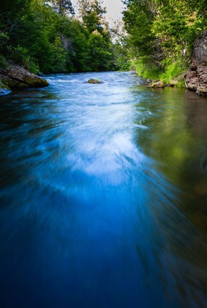 Whychus Creek. Photo: Tyler Roemer.
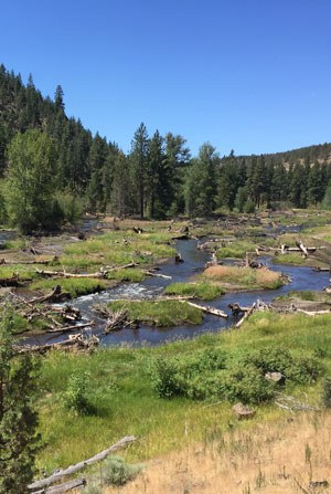 Whychus Creek after being restored. Photo: Land Trust.
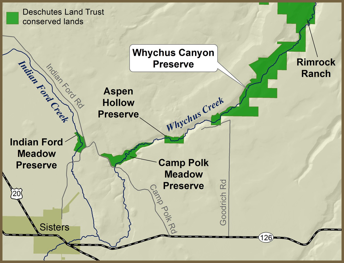
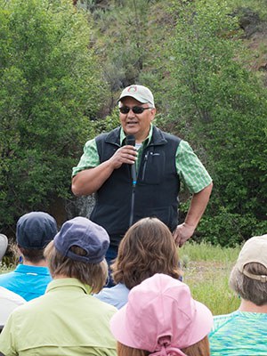 Robert Brunoe, General Manager of Natural Resources and Tribal Historic Preservation Officer for the Confederated Tribes of Warm Springs, speaks at the 2015 dedication of Whychus Canyon Preserve. Photo: Blake Boyd.